GeoPortOst
ArcGIS, QGIS or web apps can simply use this map with web map services. WMTS, TileJSON or XYZ tiles are provided for quick access to processed maps.
Sign in to get links.
Sign in to download GeoTIFF.
Overlay & compare
Website
Original viewer
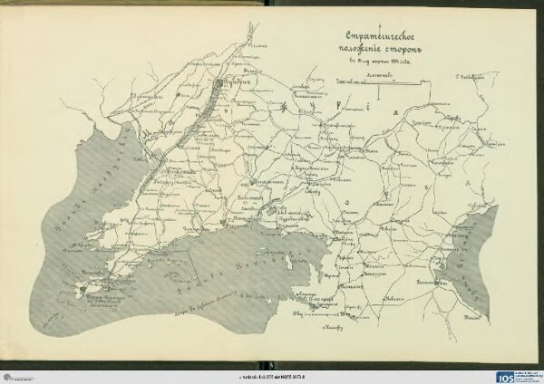
Strategičeskoe položenīe storon k 15-mu aprělja 1904 goda
BV042517792
pilot
China Mandschurei Russisch-Japanischer Krieg
1904
1911
23 × 34 cm