Projeto
Comunidade
Notícias
Meu aplicativo
Os meus mapas
Mapas de Gnarrenburg
Pesquisa avançada
Todos
Privado
Favoritos
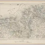
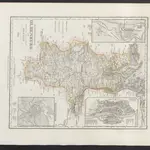
Wilhelmshaven 32, uit: [W. Liebenow's Special-Karte von Mittel-Europa]
1870|Johannes Wilhelm Liebenow 1822-1897
1:300 000
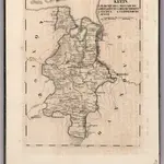
V. 2:6-10: VII. X-XI: Holstein-Oldenburg. Herzogth: Oldenburg. Kreis
1825|Hermann, O.
1:140 000
[Hamburg
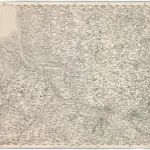
1875|Militärgeographisches Institut
1:300 000
[Herzogthum Holstein und Lauenburg, Fürstenthum Lübeck, Fr. Städte Hamburg und Lübeck nebst Amt Bergedorf]
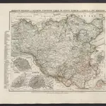
1860|Meyer, J.
Grossherzogthum Oldenburg und Gebiet der freien Stadt Bremen
1860|Meyer, J.
V. 2:6-10: VII: II. Hannover. 5. Der Grafsch: Hoya und Diepholz. 6. Das Herzogth: Bremen ...
1825|Hermann, O.
1:150 000
Holstein mit Lauenburg, Hamburg und Lubeck
1852|Radefeld, Hauptmann
1:780 000
1600
1650
1700
1750
1800
1850
1900
1950
2000
História
Mapas antigos de Gnarrenburg
Descubra o passado de Gnarrenburg nos mapas históricos
Mapas antigos de Gnarrenburg
Descubra o passado de Gnarrenburg nos mapas históricos
Explorar os mapas
Descobrir a história
Região-mãe
Rotemburgo (distrito)
Locais relacionados
© MapTiler
© OpenStreetMap
 1870|Johannes Wilhelm Liebenow 1822-18971:300 000
 1825|Hermann, O.1:140 000
 1875|Militärgeographisches Institut1:300 000
 1860|Meyer, J.
 1860|Meyer, J.
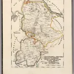 1825|Hermann, O.1:150 000
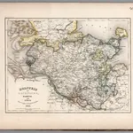 1852|Radefeld, Hauptmann1:780 000